La Toscane lisloise
Lisle-sur-Tarn is the only bastide in the Tarn plains with a port. The commercial (grain, pastel, wine, etc.) and cultural exchanges enabled by river traffic enriched the town until the 18th century. The arrival of the railway marked the end of the gabares' reign.
Lisle is also one of the most typical bastides in the southwest with its checkerboard blocks, "les moulons," its central square, "la carra" with its arcades, and the "pountets," elevated covered passages allowing street surveillance and secure passage from one block to another.
Like all towns and villages in the Tarn valley, the houses here are built of bricks (ochre-colored for raw brick, red for fired brick).
Description
- Starting from the Church of Notre Dame de la Jonquière, take the street to the right of the church, Rue de l'Ancien Collège, then turn left onto Rue Adrien Vialas. At the crossroads with the fountain and the statue of Lapérouse, you have the option to descend to the right to the old port of Lisle-sur-Tarn. Continue straight on Rue de la Chambre de l’Édit until you reach the square. Go up it on the left. At the road, turn right along Avenue Jules Ferry. Pass by the school on the developed pathway.
- At Esplanade Pierre Cayla, take Rue Pierre Salvet to the right, and immediately left on the developed passage. At the street, turn left and then right to follow another developed pathway. Continue straight ahead past Château Bellevue, then descend the path to the right. Skirt the leisure center on the right by following the fence. Continue straight to the right of the pool along the hedge until you reach the camper parking. Skirt the pond on the right and follow the road bordering the subdivision.
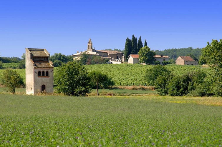
- At the crossroads, turn right. The road becomes a path. Follow it to the house. Pass to the left of the house and follow the passage between the pond and the road, under the cypress trees. Cross the stream and continue straight through the field parallel to the D988 to access a path, take it to the right to reach La Pisse. This leads to Château de Lastours. In front of the castle entrance, continue on the path straight ahead to reach the church of Saint-Vincent d’Avens. Stay on this path towards the D988, under the bridge to reach the garden center.
- Follow the road straight ahead. Cross the railway. At the crossroads, turn left on the road leading to La Sabatterie. At the crossroads, turn right until the road. Cross it to take the direction of Brancou straight ahead. Continue on the path bordered by oak trees.
- At the crossroads, in the middle of the vineyards, turn left following the GR® 46. At the parasol crossroads, continue straight. Follow this path to the houses of Saurs. At the intersection, follow the path of the blacksmith straight ahead. Optionally, turn right to visit the church of Saurs. At the D18 road, continue straight on the orchard path. Pass by a house and continue on the path. At the next intersections, always go straight. After a right turn, follow the main path to the left until the road.
- Follow the road to the right (GR® 46). At Les Cougettes, leave the road to take the path to the left. 100m further, before a left turn, leave the main path to climb left on the grassy path along a vineyard. This climbs right and then left to access below Montaigut. Follow the hollow path to the right. At the path, turn left until the church of Montaigut.
- Descend the path straight ahead. Follow the road straight ahead to pass, on the left, in front of the cemetery. Follow the descending path until the road. Cross it. At the next intersection (Bories Vieilles), leave the GR® 46 and the hills of Lisle to turn right. 500m further, at the crossroads, take the path to the left until the road. Follow it uphill to the right until the hamlet of Saint-Salvy. Turn left towards "Le Tumulus." Pass by the calvary, the church, and the cemetery of Saint-Salvy de Coutens along a vineyard. At the crossroads (calvary), optionally climb right and then left to access the Tumulus. Be careful as it is private property, please respect it. Descend the path to the left leading to a property that you cross between two barns. Descend the driveway facing the property entrance.
- At the road, turn left, then the first road to the right towards Saint-Salvy. At the crossroads behind the property, continue straight and always go straight on a path that curves to the left. At the road, turn left, then immediately right along the plantation of moyers. Follow this path to the crossroads, turn right towards Le Griffoulet. At Le Griffoulet, turn right, then descend left after the small bridge to the D988, which you cross at the traffic light. Pass under the railway, then turn left on Rue de l’Enclos and right on Porte Peyrole to reach Place Paul Saissac. Pass under the arcades in front, then turn right in front of the town hall. Follow Rue Raimond Lafage straight ahead, then Rue de l’Église to the left to return to the starting point of the route
- Departure : Church Square, Lisle-sur-Tarn
- Arrival : Same place as the start
- Towns crossed : Lisle-sur-Tarn and Gaillac
Forecast
Altimetric profile
Recommandations
Information desks
Place de la libération, 81600 Gaillac
Place Paul Saissac, 81310 Lisle-sur-Tarn
Transport
By bus: route 702 (Albi - Lisle sur Tarn - St Sulpice) - Pôle d'échange multimodale stop 600m from the starting point.
The Lastour stop is a little further away but not far from the trail (point 4).
More information on liO-occitanie (French only)
By bus: regular interurban lines (stops at La Gare, Bellevue or Les Robertes...)
More information (French only)
By train: SNCF TER Toulouse-Albi or Toulouse-Aurillac line - stop at Lisle sur Tarn station, 600m from the departure point.
More information on SNCF.
Access and parking
34 km west of Albi via the A68 (toll-free) or the D988.
Parking :
Accessibility
- Emergency number :
- 114
Report a problem or an error
If you have found an error on this page or if you have noticed any problems during your hike, please report them to us here: