
Sentier des lavoirs
The washhouses played a social role and were called "the women's parliament." They were used not only for washing clothes but especially for rinsing them. Each family was assigned the use of a washhouse. You will see three of them along the route.
"Granejouls" might come from "Grenier de Jules" (Jules' Granary). Indeed, the construction of the Toulouse-Capdenac railway line unearthed many Roman-era infrastructures, now displayed at the St. Raymond Museum in Toulouse.
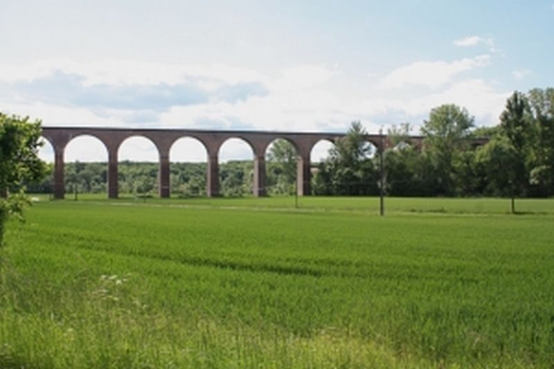
You will also see the Cahuzac viaduct, which was put into service in 1864 to allow the train to cross the valley. It has a length of 378.50 meters and consists of 19 arches
Description
- From Place du Mercadial, turn left onto the Bélautié road towards Salettes. Continue straight. At the exit of Cahuzac, turn left towards Fontanes and continue straight for 1.5 km. To see: fortified village church and frescoes by Nicolaï Greschny.
- At the road junction, turn left. Ignore a path on the right and take the next one. Cross the main road (with caution!) and continue straight ahead on the path. Pass over the railway line. At the tarmac, make a left/right turn. At the fork, turn left onto the gravel path.
- At the path intersection, go left. 50 meters further, at the four-way junction, turn left. The path follows the ridge. At the main road (with caution!), turn left and immediately right towards La Réveillé. At the fork, go left. Leave the grassy path on the left. Climb towards the place called La Réveillé.
- Facing the calvary, turn left and take the path. At the path intersection, turn left. The path descends along the woods. At the end, facing the Lafargue dovecote, turn left. Cross the Vère via the small bridge.
- At the fork, climb to the left. Ignore a path on the right. At the road, go straight on the dirt path through the undergrowth and then through the boxwood. At the exit, continue straight on the grassy path (view of Donnazac). At the road, go left. At the fork, take the path to the left. Continue straight. Pass the train bridge.
- Turn right onto the dirt path (left shortcut towards Cahuzac-sur-Vère). At the road, turn right. Leave a path on the left. At the intersection, turn left. After 250 meters, go left on the path. Go around the grove on the left.
- Take the grassy path on the left. At the next intersection, go right to the road. Turn left. At the calvary, turn right onto the path along the railway line. After 200 meters, pass under the bridge. At the road, turn right. After 50 meters, turn left. In Arzac, at the first intersection, turn right. At the exit of the hamlet, descend to the right.
- Ignore the path on the right. At the road junction, turn left. Cross the Vère bridge to reach the main road.
- Go straight (with caution!). Ignore a path on the left. Pass under the viaduct arch and climb straight on the path. At the road (former station on the left), descend straight onto the grassy path.
- Facing the main road, turn left towards Mas Brunet. Follow a water reservoir on the right. At the intersection, ignore the train bridge and go right on the gravel path. It passes near a washhouse. 10 meters further, at the fork, turn right onto the grassy path. Follow the fence.
- At the road, continue straight towards Salettes and Château de Mauriac. Follow the cemetery and continue straight. After 50 meters, descend to the right on the path. Pass near the washhouse to reach the road.
- Descend to the right (common route with the Vineyard and Châteaux trail - yellow mark) to return to Cahuzac-sur-Vère. At the stop sign, turn left and take the first street on the left to return to the starting point.
- Departure : Place du Mercadial, Cahuzac-sur-Vère
- Arrival : Same place as the start
- Towns crossed : Cahuzac-sur-Vère, Fayssac, Cestayrols, and Donnazac
Forecast
Altimetric profile
Recommandations
Information desks
Place de la libération, 81600 Gaillac
Place Jeanne Ramel-Cals, 81170 Cordes-sur-Ciel
Access and parking
22 km west of Albi via Gaillac or the D600 towards Cordes, cutting through Villeneuve sur Vère (D25), then Cestayrols (D3), and then towards Cahuzac sur Vère.
14 km south of Cordes sur Ciel via the D922.
12 km north of Gaillac via the D922.
Parking :
Report a problem or an error
If you have found an error on this page or if you have noticed any problems during your hike, please report them to us here: