Boucle de Saint-Martin
In the Middle Ages, the Church of Saint-Martin de Mours (also called "of love") stood on a feudal mound. First recorded in 1229, it was completely rebuilt in the 19th century, and its history is closely tied to the people of this community, as evidenced by two beautiful statues purchased by the inhabitants after World War I: one of the Virgin Mary, bought by the young women, and one of Saint Martin, bought by the young men.
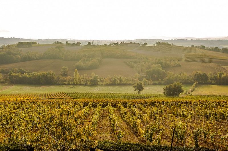
Today, a preservation association maintains the church, as is the case with many rural buildings that enrich the hiker's route. Along your path, you will discover small vineyard heritage sites, such as vineyard huts and dovecotes.
Description
- From the parking lot in front of the Las Peyras School Complex in Rabastens, go right on the path that runs along houses and then fields (common route with the Amédée the winemaker's trail). Continue straight on the flat path. Cross the road and keep going in the same direction on the grassy path.
- To access the Church of Saint-Martin de Mours: 600m round trip from Point 3.
- In front of a large brick house, turn left. Pass by a private dovecote and then a small private pond. Continue straight up the path along fields (view of the Church of Saint-Martin de Mours on the right).
- At the top of the path, turn left. At the intersection with a gravel path, in Perelles, turn left. Reach a road; turn left and then, in front of a calvary, turn right onto a dirt path.
- At the next fork, go left (another common section with the Amédée the winemaker's trail).
- Leave the path on the right (view of the Tarn Valley) and continue straight on the grassy path.
- After a bend and a house (viewing table), keep descending on the path (do not take the stairs of the Amédée the winemaker's trail). Leave a path on the right and continue straight. Upon reaching the road (place called les Bordes), turn left and return to the starting point.
- Departure : Parking of the Las Peyras School Complex, Rabastens.
- Arrival : Same place as the start
- Towns crossed : Rabastens
Forecast
Altimetric profile
Recommandations
Information desks
Place de la libération, 81600 Gaillac
Hôtel de la Fite - 2 rue Amédée Clausade, 81800 Rabastens
Transport
By bus: route 702 (Albi - Gaillac- Lisle sur Tarn-Rabastens - St Sulpice) - l'Hermitage stop 1.5 km from the starting point.
More information on liO-occitanie (in Franch only)
By train: SNCF TER Toulouse-Albi or Toulouse Aurillac line - Rabastens-Couffouleux station stop, Av. de la Gare, 81800 Couffouleux
2.2 km from the starting point.
More information on SNCF.
Access and parking
45 km southwest of Cordes sur Ciel, via Cahuzac sur Vère (D922), Gaillac, then towards Rabastens (D988).
42 km west of Albi via Gaillac.
18 km west of Gaillac via the D988.
In Rabastens, take the road to Saurs (D18) then turn onto Avenue de la Croix Blanche until you reach Las Peyras Primary School.
Parking :
Accessibility
- Emergency number :
- 114
Report a problem or an error
If you have found an error on this page or if you have noticed any problems during your hike, please report them to us here: