Chemin de Gradille
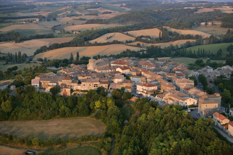
During your walk, you can admire the panoramic view of Castelnau-de-Montmiral, the Gradille Chapel dating back to the 11th century, and the small bridge that connects Saint-Jérôme to Gradille.
Description
- Starting from the cross, take the road towards Saint-Jérôme, passing by the agricultural building. At the road junction, turn left and continue for 650 meters.
- Turn right onto a path. Walk along the edge of the fields, then descend into a wooded area. Emerge onto a road; take it to the right. Pass by Labot and continue straight, skirting vineyards. At Mas de Journès, descend to the left for about 100 meters then, before a bend, take the grassy path to the right. Cross the Tescou stream.
- Leave a path on the right and, about 15 meters further, take the earthen steps on the right. Climb along the left side of the field, then enter another wooded area. The path continues straight out of the woods and emerges onto a road.
- Turn sharply and take a path through fields and vineyards (stay on the path near Palis). At a road, descend to the right. At the next intersection, ascend to the right on a road for about 500 meters. Turn left onto a gravel path towards Pommier-Long and reach a path intersection.
- Leave Pommier-Long to the left and continue straight on a dirt path towards the woods of Gradille. Reach a crossroads. The Gradille Chapel is to the left.
- Continue straight under the pine trees. Walk through the undergrowth and descend along a furrow. Cross a small bridge over the Tescou, then cross a road and continue straight ahead.
- Turn right, crossing a ditch. Climb straight, skirting a field (beware of the beehives to the right of the path). At Marevaysse, circle around a house on the left, then go right and right again. At a road, under the trees, turn left until an intersection. Ascend with a sharp left turn.
- In front of a house, take a gravel path to the right. Continue straight on this path to return to the starting point
- Departure : Parking at Croix de Saint-Jérôme, Castelnau de Montmiral
- Arrival : Same place as the start
- Towns crossed : Castelnau-de-Montmiral and Gaillac
Forecast
Altimetric profile
Recommandations
In wet weather, the route can be muddy and rutted in the Bois de Gradille.
Information desks
Place aux arcades, 81140 Castelnau-de-Montmiral
Maison Fonpeyrouse, 34 Grand rue Raimond VII, 81170 Cordes-sur-Ciel
Place de la libération, 81600 Gaillac
Access and parking
Access by car to the starting point: from the place called Colombier (southeast of Castelnau-de-Montmiral via the D964), take the D4 towards Gaillac for 400 meters, then the D5 towards Les Barrières for 1.5 km. The Croix de Saint-Jérôme is located on the left side of the road.
Parking :
Report a problem or an error
If you have found an error on this page or if you have noticed any problems during your hike, please report them to us here: