
Sentier de Mespel
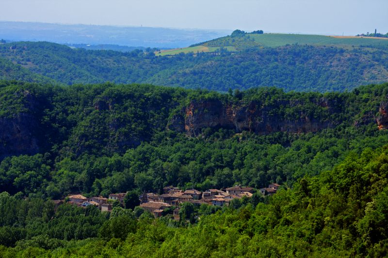
In a green setting, on the riverbank, at the foot of its pink limestone cliff, dotted with natural caves, Larroque offers a shaded and picturesque stop. The hiker follows the path that the ancient Puycelsians (inhabitants of Puycelsi) used to visit the Roucanels (inhabitants of Larroque).
There are viewpoints over the Grésigne state forest and the 13th-century Notre-Dame des Bois chapel (a 20-minute round trip from Mespel). Legend has it that twice the materials intended for its construction in the hamlet were found at the current construction site.
Description
- Facing the Larroque town hall, climb the stairs, then turn left and immediately right onto the road. Walk for 250 meters.
- At the intersection, continue straight on the gravel path. At the fork, continue straight on the path that passes through the undergrowth.
- At the crossroads (archaeological site on the right), climb to the left and continue straight under the trees. Upon reaching the open plateau dotted with oak groves and dry grasslands, continue straight up.
- Take the path to the left (white-red markings of GR® 46) and head towards Mespel. After 500 meters, you will reach the Notre-Dame des Bois Chapel (20-minute round trip). In the hamlet, cross the road and continue straight along the path that runs alongside the houses.
- At the crossroads, leave GR® 46 on the right (white and red markings) and take the path to the left (yellow markings).
- At the fork, turn right onto the winding path, cross the road, and go straight down to reach a viewpoint.
- After the viewpoint, descend the path (dangerous descent in wet weather) and then turn right to return to Larroque
- Departure : Town Hall of Larroque
- Arrival : Same place as the start
- Towns crossed : Larroque and Puycelsi
Forecast
Altimetric profile
Recommandations
Information desks
Place aux arcades, 81140 Castelnau-de-Montmiral
Place de la libération, 81600 Gaillac
3 Place de l'Ancienne Mairie, 81140 Puycelsi
Access and parking
50 km west of Albi via Gaillac, take the direction of Castelnau de Montmiral (D964) and then continue towards Puycelsi on this road.
15 km northwest of Penne via the D115 and D964 (road that skirts the Grésigne forest).
4 km west of Puycelsi via the D964
Parking :
Report a problem or an error
If you have found an error on this page or if you have noticed any problems during your hike, please report them to us here: