
Sentier des crêtes
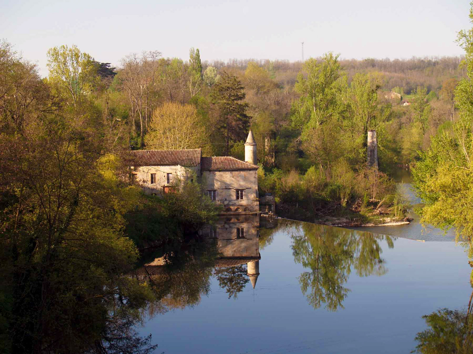
The "Place à Couverts" is characteristic of bastides, new towns created in Occitania and Aquitaine in the 13th century to boost commercial exchanges. A bit further along, you'll notice the classified MH (Monument Historique) gate of the old castle before reaching the dovecote mill on the Dadou River, near which the remains of the old railway viaduct still stand.
At the village exit, the chimney of a former brickworks catches the eye, a reminder of a now-abandoned local craft.
Throughout the route, enjoy lovely views of the churches of Saint-Martin and Cabanès.
The "Raccourci des Vignes," with its "natural" layout, will delight those seeking tranquility (starting at point 5 and ending at point 7).
Description
- From the Monument Square, next to the town hall, walk straight towards the 13th-century Place à Couverts. After the square, turn left onto the street and continue straight.
- Descend to the right on the gravel path towards the river. Cross the footbridge and follow the dirt path.
- At the intersection with the road, turn right towards the roundabout and continue in the direction of Saint-Martin. Walk 350 meters and turn left.
- At the fork, continue straight on the road. At the intersection with the D11, go straight up.
- At the next intersection, continue straight to stay on the Crêtes Trail (left is "Sentier des Crêtes, raccourci des vignes").
- At the crossroads, take the grassy path. Pass through the field (beware of beehives!) and go straight up through the woods.
- Turn left and head up towards Grèzes on the grassy path.
- At the intersection with the road, turn left and walk 250 meters, then turn left onto the path (with a beautiful view of the Dadou Valley). Continue through the Grèze Plain and cross the Carrelié woods to Namans. Continue straight from En Ségur to Borie Blanche.
- At this intersection, turn left and walk 450 meters to reach the road, then turn right to descend back to the village.
- Departure : Place du monument, Briatexte
- Arrival : Same place as the start
- Towns crossed : Briatexte and Saint-Gauzens
Forecast
Altimetric profile
Recommandations
Information desks
Place de la libération, 81600 Gaillac
rue Saint-Jean, 81300 Graulhet
Transport
By bus: line 756 (Graulhet - Toulouse) or 705 (Albi- Graulhet- Lavaur) - Centre stop
More information on liO-Occitanie (French only)
Access and parking
20 km from Gaillac via the A68, exit 8: take the D87 towards Parisot, then turn left onto the D14 towards Briatexte.
Parking :
Accessibility

- Emergency number :
- 114
Report a problem or an error
If you have found an error on this page or if you have noticed any problems during your hike, please report them to us here: