Cordes heritage trail
Crossing Cordes adds significant heritage value to this route, which is further enriched by other interesting historical elements:
In the 14th century, Cordes had fifteen fortified gates. You will pass through only the remaining five. Admire the exceptional facades of Gothic houses from the 13th and 14th centuries. You will walk by the Gaudane embroidery workshop, where nearly 300 mechanical embroidery machines clicked away in the early 19th century.
In the valley, and particularly in Les Cabannes, the water of the Cérou was used by tanners. The leather was then sold by wealthy merchants from Cordes. This activity continued from the 14th to the 19th century in the houses you will find between Place St Félix and Rue des Tanneries.
Just after point 3, you will follow an old railway line connecting Carmaux to Vindrac. It was used to transport coal from the Carmaux mines and a few passengers “without luggage.” It operated for only 2 years (1937 to 1939) after 60 years of planning!
The Nauze, in Occitan, means "the marsh": pond, lagoon, or marshy meadow, suggesting that this area was frequently flooded. A little further, your route will lead you to the beautiful "Pont des Anes" (Historic Monument), featuring two arches and dating back to the 14th century. It is associated with the Moulin de La Bogne and was built to facilitate mule or donkey traffic related to milling activities.
Near the church of St-Martin de Vindrac, there was a vast Gallo-Roman villa covered in the 4th century by a Merovingian necropolis consisting of a small building and 120 sarcophagi, reflecting some of the earliest local Christian practices. Ten years of excavation uncovered only part of the site. Some remains are preserved in the community hall next to the church.
At Les Fargues, before turning left, take a few steps to admire the tall sandstone "turning" cross (a recent copy). It depicts the crucifixion and figures related to Christian charity: Saint Martin on horseback and Mary Magdalene, the patroness of cord makers. According to tradition, it protected crops from storms by orienting the figures towards the storm. The 15th-century original (Historic Monument) is kept in the community hall of Vindrac.
The name of the village Les Cabannes ("cabanas" in Occitan) refers to the modest dwellings occupied by the quarrymen who extracted the stones needed for the construction of Cordes. The Corrompis Quarry, not far from your path, is still in operation.
At point 11, take a moment to stop at this peaceful and historically rich site: the Saint-Jean de Mordagne Chapel, which dates back to the 11th century. It is one of the few chapels with a rounded apse and an ogee arch (choir). During the plagues of the 16th and 17th centuries, wooden huts in this valley housed the plague-stricken from the Cordais area, who were then buried on site, and their dwellings were burned.
Description
- Follow the GR®36 from Place Jeanne Ramel-Cals: climb up Grand’Rue de l’Horloge. Pass through the Porte du Vainqueur and then the Porte du Portail-Peint. Emerge onto Grand’Rue Raymond VII. Continue to Place de la Halle. Descend to Porte des Ormeaux. Go through it and immediately turn right, then leave the town through Porte de la Jane, continuing to follow the GR®36 (be careful at the Redoulets: stairs can be very slippery when wet).
- Cross the D600 (beware!). Continue towards "Tanneries-Collège". Follow Rue des Tanneries to Place Saint-Félix des Cabannes.
- Head right on the D30. Cross the Cérou bridge. Walk for 250 meters. Turn left onto the embankment and take the GR® de Pays. Continue for 500 meters on the Voie Verte.
- Pass the wooden barrier. Turn right onto the dirt path. At the Nauze, continue straight towards the woods. Do not take the GR® de Pays that climbs to the right but go straight to the D7. Turn right along the Cérou. Pass the Moulin de la Bogne. Walk 100 meters on the road.
- Take the old bridge to the left, known as the "Pont des Ânes". After 100 meters, turn right onto the dirt path (beware of flooding; climb the embankment if necessary). Continue for 1 km to Vindrac.
- Follow the church and then turn right along the cemetery to circle the village by the mill and its pond. Stay on the left and turn right onto the tree-lined road to reach the D600. Cross the road (be careful!) to reach the road sign for Péteulé. Continue 2 km on the road that ascends to the hamlet of Les Fargues.
- At Les Fargues, admire the cross. Go back and take the dirt path. Continue straight to the junction with the GR® de Liaison (red and white markers).
- Continue left to the farm shed. Turn right towards Piton and follow the ravined path bordered by stone walls. Go to the road.
- Take the road to the right for 120 meters. At the intersection, turn left towards La Devèze. Cross the Aurosse. Climb straight up the path.
- Turn right, under the convent, and follow the small path towards Bouysset. Descend the road for 500 meters. Cross the Aurosse again. Ignore La Bouriette to the right. Arrive at a crossroads. Continue straight along the path lined with plum trees.
- Leave the path to admire the Saint-Jean Chapel. Resume the path (please respect the private property you are passing). After the tennis court and an old washhouse, climb left up the path. Stay on the path to the left for 700 meters. Emerge at a fork.
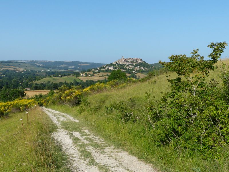
- Take the left path (PR Sentier du Causse) for 1.5 km towards Cordes and admire the silhouette of Cordes one last time. Climb up Rue de Litou to return to the starting point
- Departure : Jeanne Ramel-Cals Square, Cordes-sur-Ciel
- Arrival : Same place as the start
- Towns crossed : Cordes-sur-Ciel, Les Cabannes, Vindrac-Alayrac, and Souel
Forecast
Altimetric profile
Recommandations
Leaving Cordes: at the Redoulets steps, beware of slipping in wet weather: a sign on the spot warns of this.
Climb the embankment if the path between Pont des Anes and Vindrac is flooded.
Transport
By bus: route 707 (Albi-Cordes-Vindrac) - stop 100 m from the starting point.
By train: TER Toulouse-Aurillac line - "Cordes-Vindrac" SNCF station 5 km away.
Access and parking
25 km northwest of Albi via the D600.
25 km north of Gaillac via the D922.
Parking :
Accessibility
- Emergency number :
- 114
Report a problem or an error
If you have found an error on this page or if you have noticed any problems during your hike, please report them to us here: